Korean Society as Seen through Maps
Through maps showing Korea's population distribution, the distribution of ethnic Koreans abroad, etc., one can see the development of contemporary Korea into a multicultural society.
목차
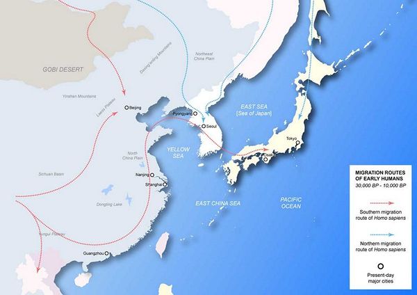
Early Human Migration to Korea
This map shows prehistoric migration paths of humans to the Korean peninsula.
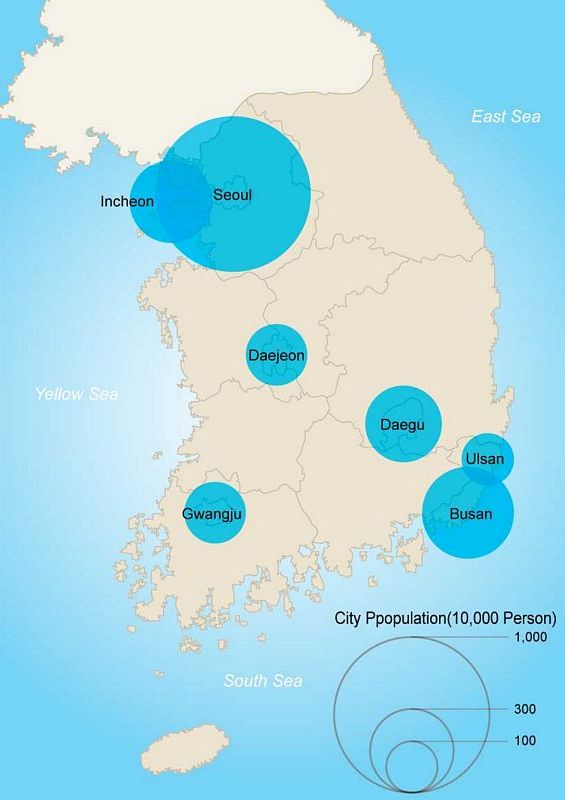
Population of South Korea
This map shows the distribution of the Korean population in key cities such as Seoul.
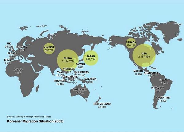
Korean Immigrants Abroad
This map shows the distribution of ethnic Koreans abroad living in places such as North America, Central Asia, China, Japan, and more.
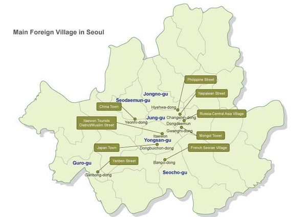
Foreign Villages of Seoul
This map shows enclaves of various foreign ethnic groups in Seoul, such as the Chinatown of Yeonhui-dong, the Russia-Central Asia village near Dongdaemun, the French Seorae village in Banpo-dong, the Japanese village in Dongbuichon-dong, Yanbian street in Garibong-dong, and others.


