"마산동 산성"의 두 판 사이의 차이
Mkichukova (토론 | 기여) (→영문) |
|||
| 34번째 줄: | 34번째 줄: | ||
'''Fortress in Masan-dong''' | '''Fortress in Masan-dong''' | ||
| + | This fortress is a stone fortress encircling the summit of Seongjaesan Mountain (200 above sea level) and it is presumed to have been built in the early 7th century during the Baekje period (18 BCE–660 CE). Many small fortresses, including Gyejoksanseong Fortress, can be found on the mountain to the west of Daejeon valley, suggesting that they have served to watch over the eastern section of the Okcheon area. Among these, Fortress in Masan-dong is located in the easternmost part which is a good location for commanding a panoramic view of the Geumgang River basin in the Daecheongho Lake area. It is valuable in that it overlooks the road that goes to the gate to the west. | ||
| + | |||
| + | The fortress is long and rectangular in shape, oriented on an east-west axis, and the perimeter of its wall measures about 220 m. The outside was constructed by stacking stones while cutting the steepness of the mountain, and the inside – by filling it with earth and stones. The site remaining nearby the northeastern section of the wall is presumed to have been a command post from which a commander would direct the soldiers, or a beacon station facility. It is presumed that there has been a tank in the sunken part of that area. | ||
===영문 해설 내용=== | ===영문 해설 내용=== | ||
2021년 7월 4일 (일) 20:11 판
| 마산동 산성 Fortress in Masan-dong |
|
 마산동산성, 국가문화유산포털, 문화재청. |
|
| 대표명칭 | 마산동 산성 |
|---|---|
| 영문명칭 | Fortress in Masan-dong |
| 한자 | 馬山洞 山城 |
| 주소 | 대전광역시 동구 마산동 산6 번지 |
| 지정번호 | 대전광역시 기념물 제30호 |
| 지정일 | 1993년 6월 21일 |
| 분류 | 유적건조물 / 정치국방 / 성 / 성곽 |
| 시대 | 백제 |
| 수량/면적 | 2,281㎡ |
| 웹사이트 | 마산동산성, 국가문화유산포털, 문화재청. |
|
|
|
해설문
국문
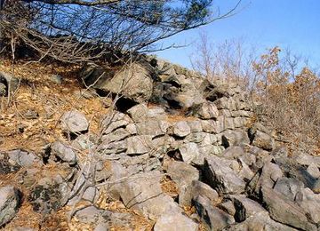
마산동산성은 대전 분지의 동쪽을 경계하기 위하여 정상부 주변을 돌려 가며 쌓은 백제시대 산성이다. 분지의 동쪽 산지에는 계족산성을 비롯하여 작은 산성들이 많이 분포하고 있는데, 이들은 모두 계족산성의 보조산성 역할을 하고 있다. 동쪽의 옥천 지역을 경계하는 기능을 갖고 있는 마산동산성도 그중 하나이다.
분지의 가장 동쪽에 있는 이 성은 대청호 일대의 금강 유역을 조망하기에 좋고, 서쪽으로는 미륵원지에서 문의 쪽으로 향하는 통로를 감시하는 데 유리하다.
성의 형태는 산봉우리 주위를 둘러싸며 동서 방향으로 길다란 장방형 평면을 하고 있다. 동북쪽 성벽 근처에는 군사를 통솔하는 장대 건물터나 봉수시설로 추정되는 대지가 있다. 그 주변에는 함몰된 부분이 있는데, 저수시설이 있었던 듯하다.
이 성은 무너진 부분에서 산의 경사면을 깎아 내고 외벽을 쌓은 후, 그 안쪽에 돌과 흙을 채워 넣는 수법으로 축성되었다. 이러한 축성 수법으로 볼 때 질현성을 비롯한 여러 산성의 축성 수법과 비슷하여 7세기 전반 백제시대에 축성한 것으로 추정할 수 있다.
영문
Fortress in Masan-dong
This fortress is a stone fortress encircling the summit of Seongjaesan Mountain (200 above sea level) and it is presumed to have been built in the early 7th century during the Baekje period (18 BCE–660 CE). Many small fortresses, including Gyejoksanseong Fortress, can be found on the mountain to the west of Daejeon valley, suggesting that they have served to watch over the eastern section of the Okcheon area. Among these, Fortress in Masan-dong is located in the easternmost part which is a good location for commanding a panoramic view of the Geumgang River basin in the Daecheongho Lake area. It is valuable in that it overlooks the road that goes to the gate to the west.
The fortress is long and rectangular in shape, oriented on an east-west axis, and the perimeter of its wall measures about 220 m. The outside was constructed by stacking stones while cutting the steepness of the mountain, and the inside – by filling it with earth and stones. The site remaining nearby the northeastern section of the wall is presumed to have been a command post from which a commander would direct the soldiers, or a beacon station facility. It is presumed that there has been a tank in the sunken part of that area.
영문 해설 내용
마산동 산성은 성재산(해발 200m) 정상부를 둘러 쌓은 석성으로, 백제시대인 7세기 전반에 만들어진 것으로 추정된다. 대전 분지의 동쪽 산지에는 계족산성을 비롯한 작은 산성들이 많이 분포하고 있으며, 동쪽의 옥천 지역을 경게하는 역할을 했던 것으로 보인다. 마산동 산성은 그중에서도 가장 동쪽에 위치하고 있으며, 대청호 일대의 금강 유역을 조망하기에 좋은 위치이다. 서쪽으로는 문의 쪽으로 향하는 길을 감시하는 데 유리하다.
성의 형태는 동서 방향으로 길다란 장방형이며, 성벽의 둘레는 약 220m이다. 산의 경사면을 깎아 바깥쪽에는 돌을 쌓고 안쪽에 돌과 흙을 채우는 방식으로 축성되었다. 동북쪽 성벽 근처에서는 장수가 군사를 지휘하던 장대 혹은 봉수시설로 추정되는 자리가 남아있다. 그 주변에 함몰된 부분은 저수시설이 있었던 곳으로 보인다.
참고자료
- 『동구의 산성』, 대전동구문화원, 2002, pp.44-58(https://www.nculture.org/sch/totalSearchList.do) -> 전체 성벽의 둘레는 약 220m로 비교적 소규모에 해당된다.
- 마산동산성, 한국민족문화대백과사전 http://encykorea.aks.ac.kr/Contents/Item/E0017362 -> 사슴이골이라고 하는 이름을 따서 일명 ‘녹동산성(鹿洞山城)’이라고 부르기도 한다. / 이 성은 표고 150m의 고지에 쌓은 활[弓]처럼 구부러진 산세에 따라 테뫼식(산 정상을 둘러 쌓은 성)으로 축조한 석축산성이다. 둘레는 약 600m 정도 되나 흔적만 남아 있을 뿐 대부분 붕괴되어 있다. (수치에 차이가 있음)
- 동서남북 확 트여 괜히 기분이 좋아지는 곳, 오마이뉴스, 2021.5.13. http://www.ohmynews.com/NWS_Web/View/at_pg.aspx?CNTN_CD=A0002743041