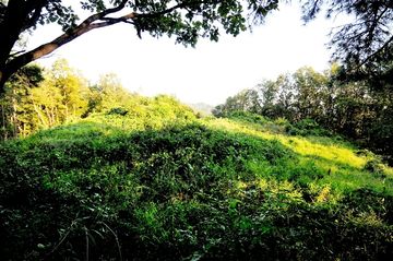
독산 봉수지
| 독산 봉수지 |
|
| 대표명칭 | 독산 봉수지 |
|---|---|
| 한자 | 禿山 烽燧址 |
| 주소 | 경기도 포천시 신북면 기지리 590 |
| 지정(등록) 종목 | 포천시 향토유적 제51호 |
| 지정(등록)일 | 1986년 4월 9일 |
| 소유자 | 포천시 |
|
|
|
해설문
국문
독산 정상부에 설치되었던 봉수대의 터이다. 봉수대는 낮에는 연기(燧)로, 밤에는 횃불(烽)을 들어 정해진 신호를 보내는 근대 이전의 군사 통신시설이다.
이 봉수 터는 '봉화뚝'이라고도 불린다. 산의 정상에 약 2,645㎡의 대지가 조성되어 있는데, 산등성이부터 흙으로 쌓은 단을 형성하여 정상부를 확장하였다. 이곳에서는 포천 시내와 반월산성(半月山城), 신북면 일대가 잘 조망된다. 포천에는 북쪽에서부터 혜재곡, 적골산, 미노곡, 독산, 잉읍점 등 다섯 개 봉수가 있다. 이는 조선 초기부터 후기까지 큰 변동 없이 유지되었던 봉수노선으로, 경기 북부지역에 비상사태 발생 시 혜재곡 또는 적골산에서 미노곡⟶독산⟶잉읍점으로, 다시 남양주를 거쳐 서울 아차산 쪽으로 이어졌다.
영문
Doksan Beacon Station Site
Beacons were a type of a smoke-and-fire-signal communication system to warn of military events such as enemy invasions. The beacons, which are located atop mountains for visibility, had five furnaces which were lit in a particular pattern to indicate the severity of the situation. In the Joseon period (1392-1910), information was relayed to the central government in the capital (today's Seoul) through a network of beacon stations across the nation. This system was operational until 1894 when the modern communication system was introduced.
Doksan Beacon Station, located on the peak of Doksan Mountain (225 m above sea level), is presumed to have been built prior to 1454. It belonged to Main Line No. 1, which began in the far northeast corner of the peninsula in Gyeongheung (in today's North Korea) and ended in the capital. The station received signals from Mirogok Beacon Station in the north and sent the signal southward to Ingeupjeom Beacon Station.
This site was excavated in 2017. Excavations revealed the remains of a protective wall, a furnace platform, three of the five furnaces, a storeroom, and five pits in which shards of roof tiles, earthenware, and white porcelain were found.
