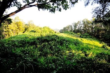
독산 봉수지
| 독산 봉수지 |
|
| 대표명칭 | 독산 봉수지 |
|---|---|
| 한자 | 禿山 烽燧址 |
| 주소 | 경기도 포천시 신북면 기지리 590 |
| 지정(등록) 종목 | 포천시 향토유적 제51호 |
| 지정(등록)일 | 1986년 4월 9일 |
| 소유자 | 포천시 |
|
|
|
해설문
국문
독산 정상부에 설치되었던 봉수대의 터이다. 봉수대는 낮에는 연기(燧)로, 밤에는 횃불(烽)을 들어 정해진 신호를 보내는 근대 이전의 군사 통신시설이다.
이 봉수 터는 '봉화뚝'이라고도 불린다. 산의 정상에 약 2,645㎡의 대지가 조성되어 있는데, 산등성이부터 흙으로 쌓은 단을 형성하여 정상부를 확장하였다. 이곳에서는 포천 시내와 반월산성(半月山城), 신북면 일대가 잘 조망된다. 포천에는 북쪽에서부터 혜재곡, 적골산, 미노곡, 독산, 잉읍점 등 다섯 개 봉수가 있다. 이는 조선 초기부터 후기까지 큰 변동 없이 유지되었던 봉수노선으로, 경기 북부지역에 비상사태 발생 시 혜재곡 또는 적골산에서 미노곡⟶독산⟶잉읍점으로, 다시 남양주를 거쳐 서울 아차산 쪽으로 이어졌다.
영문
Beacon of Doksan
Beacons were a type of a smoke-and-fire-signal communication system used in times of emergency. They were located on mountain tops for visibility and produced smoke during the day and fire at night in a particular pattern to indicate the severity of the situation.
The Doksan Beacon covers an area of 2,645㎡ enlarged by piling earth to provide a panoramic view of downtown Pocheon, Banwol Mountain Fortress and Sinbuk-myeon.
Since the early Joseon period (1392-1910) there were five beacons guarding Pocheon city; from the north these are Hyejaegok, Minogok, Jeokgolsan Mountain, Doksan and Ingeupjeom. In times of emergency, signals were transmitted via these beacons to Seoul.
