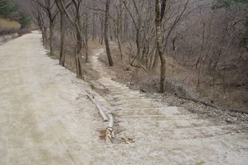
문경새재
| 문경새재 Mungyeongsaejae Pass |
|
 문경새재, 국가문화유산포털, 문화재청. |
|
| 대표명칭 | 문경새재 |
|---|---|
| 영문명칭 | Mungyeongsaejae Pass |
| 한자 | 聞慶새재 |
| 주소 | 경상북도 문경시 문경읍 새재로 1156 |
| 지정(등록) 종목 | 명승 제32호 |
| 지정(등록)일 | 2007년 12월 17일 |
| 분류 | 자연유산/명승/역사문화명승/ |
| 수량/면적 | 3,768,307㎡(지정구역) |
| 웹사이트 | 문경새재, 국가문화유산포털, 문화재청. |
|
|
|
해설문
국문
문경새재는 조선의 옛길을 대표하는 관도(官途)로, 영남에서 한양으로 가는 가장 빠른 길이며, 과거를 보러가는 선비들이 주로 이용하였다. 『세종실록지리지』에는 ‘풀(억새)이 우거진 고개’라는 뜻의 ‘초점(草岾)’으로, 『동국여지승람』에는 ‘새들도 쉬어 넘는 힘든 고개’라는 뜻의 ‘조령(鳥嶺)’으로 기록되어 있다.
조선 태종 14년(1414)에 문경새재 계곡을 따라 제3관문(조령관)까지 650m에 이르는 고갯마루를 닦았다. 이로써 문경에서 괴산, 연풍을 잇는 대로(大路)가 개통되어 조선시대 영남대로에서 충청도(한강유역권)와 경상도(낙동강유역권)를 가르는 백두대간을 넘는 주도로 기능을 했다.
문경새재는 산성을 쌓는데 유리한 조건을 갖추고 있어 제1관문 주흘관, 제2관문 조곡관, 제3관문 조령관 등 3개의 관문(사적 제147호)과 국립 여관에 해당하는 원(院)터 등 주요 관방시설이 자리하고 있다. 이 밖에도 정자, 주막터, 성황당 그리고 각종 비석 등이 옛길을 따라 남아 있다. 경상도 선비들의 과거길로서 수많은 설화가 내려오고 있는 등 역사적, 민속적 가치가 높은 조선 최고의 옛길이다.
문경새재 일대는 주흘산, 조령산의 다양하고 아름다운 식생 경관과 옛길 주변의 계곡과 폭포, 숲길 등 경관 가치가 뛰어나다. 현재 ‘옛길 걷기체험’등 옛길과 관련하여 여러 가지 다양한 체험 행사가 해마다 열리고 있어 현대인들의 조선시대 옛길과 선비 문화를 누릴 수 있다.
영문
Mungyeongsaejae Pass
Mungyeongsaejae Pass is a passageway between Juheulsan and Joryeongsan Mountains. Shortly after the establishment of the Joseon dynasty in 1392, a road network connecting the capital, Hanyang (in today's Seoul), with other parts of the country, was restructured. In 1414, Mungyeongsaejae Pass, a 650 m section of this road, was opened. It was located halfway along the main road connecting the capital and Dongnae (in today’s Busan) in the southeast.
Mungyeongsaejae Pass was an important road maintained by the state. Along such roads, lodging facilities were placed at regular intervals, so that traveling officials could rest along the way. Mungyeongsaejae Pass had strategic value to the military as well. However, it was not properly defended, so during the Japanese invasion of 1592, Korean troops suffered a defeat at the hands of Japanese troops who had entered the area by this passageway. Therefore, beginning in 1594 three gates were built along the path to better guard the road.
This pass was often taken by Confucian scholars from the southeast region, who were on their way to the capital to take the state examination, hence its other name, "the state examination road." There were other mountain passes on the way to the capital at that time, but the scholars preferred Mungyeongsaejae Pass. Not only was it the fastest way to the capital, but also the characters "mungyeong" in the name of the road translate to "hearing joyous news," which was considered good luck for the hopeful examinees**.
The characters "saejae" in the name can be interpreted variously as "a dangerous pass which only birds can fly over safely," "a pass of thickly growing silver grass," or "a newly laid mountain road."
The old trail of Mungyeongsaejae Pass stretches through beautiful natural scenery including valleys, waterfalls and forests. It was therefore designated as a provincial park in 1981, and later as a scenic site in 2007. Located within the park is a set for filming historical dramas which was established in 2000.
영문 해설 내용
문경새재는 주흘산과 조령산 사이에 위치한 고개이다. 조선 건국 직후 수도인 한양을 중심으로 전국을 연결하는 도로망이 정비되었으며, 이곳에 650m에 이르는 고갯길은 1414년에 개통되었다. 동래(지금의 부산)와 한양을 잇는 영남대로 상에 위치하고 있었다.
국가에서 마련한 길인만큼, 관리들이 묵을 수 있도록 일정 거리마다 숙박시설이 마련되어 있었다. 또한 이곳은 군사적 요충지이기도 하였다. 1592년 임진왜란 때 이곳을 넘어온 일본군에게 크게 패한 후 1594년부터 총 3개의 관문을 지었다.
영남의 유생들이 과거를 보기 위해 한양으로 올라갈 때 사용한 길로, ‘과거길’이라고도 불렸다. 영남에서 한양으로 가는 길은 다른 고갯길도 있었지만, 대부분의 유생들은 이 길을 택했다. 이 길로 가는 것이 가장 빠르기 때문이기도 했지만, ‘문경’이 ‘경사스러운 소식을 듣는다’는 뜻이기 때문이기도 했다.
‘새재’라는 이름에는 ‘새나 넘을 수 있는 험한 고개’, ‘억새가 우거진 고개’, ‘새로 낸 고갯길’이라는 여러 가지 뜻이 있다.
문경새재 일대는 옛길 주변의 계곡과 폭포, 숲길 등 자연 경관이 아름답다. 현재 ‘옛길 걷기체험’등 옛길과 관련하여 여러 가지 다양한 체험 행사가 해마다 열리고 있다.